

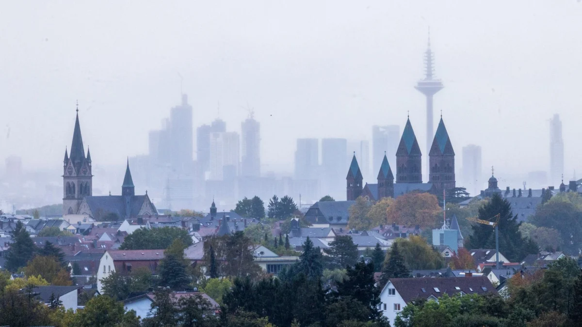
Hesse is currently bracing for a volatile weekend as a rapid succession of two significant low-pressure systems, designated "Luise" and "Manja," sweeps across the German state. Meteorological forecasts indicate a period of intense atmospheric instability, characterized by heavy rainfall and high-velocity wind gusts that threaten to disrupt travel, outdoor activities, and local infrastructure.
As the autumn season takes a decisive and "ruffled" turn, experts are advising citizens to exercise extreme caution, particularly regarding safety in forested areas where trees, already weakened by a long, dry summer, are susceptible to wind damage. While the immediate outlook is dominated by turbulent weather, the transition into the coming week offers a glimmer of hope as a high-pressure system promises to usher in a period of "golden" autumn calm.
A Chronology of the Stormy Weekend
The weather event is unfolding in two distinct phases, creating a brief but deceptive lull in the middle of the weekend.
Friday: The Arrival of Low-Pressure System "Luise"
The atmospheric upheaval began in earnest on Friday afternoon. As the low-pressure system Luise tracked across the region, wind speeds began to escalate. By Friday evening and into the early hours of Saturday, meteorologists predicted significant gusts. In the higher altitudes of Hesse’s mountainous regions, winds were expected to reach speeds of approximately 85 kilometers per hour. Meanwhile, in the lower-lying areas, residents were warned of gusts reaching up to 70 km/h. The Deutscher Wetterdienst (DWD) issued a series of official weather alerts, urging the public to stay informed and exercise vigilance.

Saturday: The Brief Lull
The transition between the two systems will occur on Saturday afternoon. Meteorologist Tim Staeger of the Hessenschau weather service characterized this interval as a necessary "pause between two storms." However, he warned that the respite would be short-lived, noting the ominous meteorological reality that "after the storm is before the storm."
Saturday Night to Sunday: The Onset of "Manja"
The second, more powerful system, Manja, is expected to make its presence felt starting Saturday evening. Manja is forecast to be larger and more aggressive than its predecessor, Luise. The duration of this second event will extend through the night and persist until midday on Sunday. During this period, the intensity of the winds will escalate significantly, with the DWD predicting that gusts in the mountainous regions of North and Central Hesse could exceed the 100 km/h threshold. In the flatlands, wind speeds are anticipated to hover between 70 and 85 km/h, accompanied by persistent and heavy rainfall.
Meteorological Data and Rainfall Projections
The impact of these two systems is not limited to wind damage; the cumulative rainfall is expected to be substantial. Over the course of the weekend, as both Luise and Manja traverse the state, meteorologists are projecting total precipitation levels that could reach 50 to 70 liters per square meter in the windward "stau" locations, such as the Westerwald and the Upland region.
Central and Northern Hesse can expect cumulative totals between 30 and 50 liters, while Southern Hesse is anticipated to receive between 15 and 30 liters.

The Context of October Precipitation
This influx of water comes at a time when the region has already seen a significant portion of its monthly expected rainfall. As of Friday, October had already yielded approximately two-thirds of its historical average precipitation in many parts of the state. In Southern Hesse, the figures currently sit at around 50 percent. Meteorological analysis suggests that once the current weather events conclude, many regions will likely exceed their monthly precipitation averages. This rapid accumulation, while beneficial for soil moisture after the historic drought conditions of the summer, also brings the risk of localized surface flooding and waterlogged terrain.
Expert Analysis and Safety Implications
The meteorological community, led by experts like Tim Staeger, is emphasizing the specific dangers associated with this current autumn weather pattern. The primary concern is the integrity of the state’s forests. Following a summer characterized by persistent drought, many trees have suffered from structural stress. This has left them significantly more vulnerable to wind-throw and falling branches.
Safety Precautions
- Avoid Forested Areas: Meteorologists have issued a clear, urgent warning against hiking or visiting wooded areas during the height of the storm. The risk of falling branches—even from trees that appear healthy—is elevated during high-wind events.
- Securing Property: Homeowners are advised to secure loose outdoor furniture, decorations, and garden equipment that could become dangerous projectiles in 100 km/h winds.
- Traffic Caution: Drivers should anticipate debris on roadways and exercise extra caution, particularly on roads lined with trees or in exposed mountain passes.
Looking Ahead: The Return of the "Golden" Autumn
By the afternoon of Sunday, the influence of Manja will begin to wane, and the atmospheric pressure is set to shift. The upcoming week promises a marked change in the weather, as a stable high-pressure system begins to push into the region.
This development is expected to bring a period of significant weather stabilization. While the beginning of the week on Monday and Tuesday may still see residual isolated showers, the overall trend is toward clearing skies. The sun is expected to make more frequent appearances, though its visibility will depend on the density of the morning fog and low-lying clouds that often accompany autumn high-pressure systems.

Temperatures are expected to remain moderate, with daytime highs ranging from 10 to 14 degrees Celsius, and potentially reaching a mild 17 degrees in parts of Southern Hesse. This anticipated weather pattern could usher in a "golden" phase for the remainder of October and potentially into early November, providing a stark contrast to the turbulent, wet conditions currently gripping the state.
Conclusion
The current situation serves as a poignant reminder of the volatility of the autumn season in Central Europe. While the dual-pronged attack of Luise and Manja brings potential for damage and significant disruption, the meteorological infrastructure in place—ranging from early warning systems to public awareness campaigns—is designed to mitigate these risks.
Residents are encouraged to stay connected to local weather apps and news channels for real-time updates, especially as the intensity of the storm shifts during the Saturday night transition. By adhering to expert advice and staying clear of vulnerable areas during peak wind conditions, the population can navigate this "ruffled" side of autumn safely until the promised stability of the coming high-pressure system arrives to restore calm to the Hessian landscape. As the region transitions from the remnants of summer drought to a potentially record-breaking month of rainfall, the resilience of both the landscape and the community will be tested, but the forecast provides a clear path toward clearer, sunnier days ahead.