
The Faroe Islands, a jagged archipelago of eighteen islands suspended in the North Atlantic, represent one of the last true frontiers of European wilderness. Located halfway between Scotland and Iceland, these islands are defined by a relentless, primordial struggle between the raw, volcanic geology of the North Atlantic and the unforgiving climate that dictates life on the islands. To visit the Faroes is to accept the dominance of the elements; it is a landscape where time is measured not by the clock, but by the wind speed and the capricious moods of the ocean.
A Legacy of Resilience: The Story of Nólsoyar Páll
In Klaksvík, the second-largest town on the islands, history is not merely found in archives—it is built into the structures themselves. Archibald Black, a resident in his mid-sixties, lives in a house he spent six years constructing by hand, eschewing a single nail in favor of traditional techniques. The house is a precise reconstruction of an 18th-century dwelling that once belonged to Nólsoyar Páll, the undisputed national hero of the Faroes.
Páll, a figure whose legacy teeters between that of a swashbuckling Robin Hood and a rogue, was a visionary. In 1804, when local banking institutions refused to finance his ambitions, Páll took the radical step of building his own ship for transatlantic commerce. Beyond his nautical feats, he is remembered for his humanitarian ingenuity. During a voyage back from England, he personally vaccinated his crew against smallpox, keeping the vaccine "alive" by passing it from person to person—a necessity in an era before mechanical refrigeration. Upon arrival, he successfully inoculated the entire population of the islands. His life eventually ended as it began—in the pursuit of the public good—when he disappeared in a storm while transporting grain to prevent a famine among his people.
The Geography of the Elements
The topography of the Faroe Islands is a testament to the power of erosion. Most of the islands’ fjords and valleys stretch in a southeast-to-northwest direction, largely aligned with the prevailing southwesterly winds. While the inland valleys offer pockets of relative shelter, the west coast bears the full brunt of the ocean. At Cape Enniberg on the island of Viðoy, sheer cliffs rise 754 meters vertically from the churning sea, a stark reminder of nature’s indifference to human scale.
Historically, the rugged terrain made inter-village travel a monumental task. Before the modern era of sub-sea tunnels, the only way to traverse the islands was by foot, navigating treacherous mountain passes. Today, these ancient footpaths have been repurposed as official hiking trails, serving as the primary way for visitors to experience the archipelago’s true character.
Chronology of an Expedition: Three Days in the Clouds
Day One: The Pass of Áarskarð
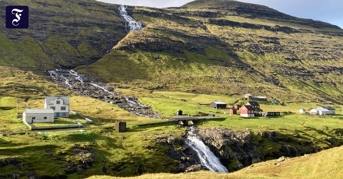
The journey began with an ascent over the pass of Áarskarð, following the path once walked by Páll. The wind here is a living entity. It dictates the movement of everything: grass, hair, and even the cascading water of the island’s numerous falls, which are frequently blown upward by the force of the gusts. The landscape is a saturated, boggy expanse of peat, where water seems to manifest from the earth itself. As one crests the ridge, however, a sudden, eerie silence takes hold. The pass acts as a natural windbreak, creating a microclimate of stillness. Looking back toward the coast, the "Windsbraut"—the bride of the wind—remains visible, forcing waterfalls to flow backward in a surreal display of kinetic energy.
Day Two: The Logistics of Isolation
By the second day, the reality of Faroese infrastructure became clear. The islands are connected by 22 tunnels, including a marvel of engineering: an eleven-kilometer sub-sea tunnel featuring the world’s first underwater roundabout. Despite this modernity, the sea remains the ultimate arbiter of transport.
Attempts to reach the remote island of Fugloy via ferry were thwarted by the conditions. At the ferry terminal, the crew was busy loading heavy machinery and livestock—a reminder that the ferries are the vital lifelines for the islands’ residents. The captain ultimately aborted the docking maneuver at Hattarvík, as the waves were cresting too violently against the stone quay. For the stranded traveler, the lesson was clear: in the Faroes, you do not travel on a schedule; you travel when the ocean permits.

Day Three: The Endlessness of the Tundra
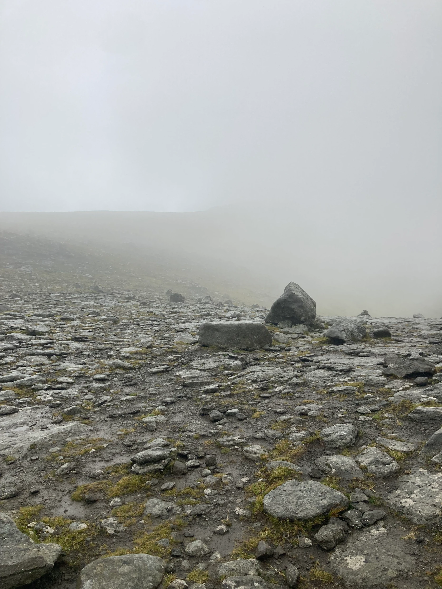
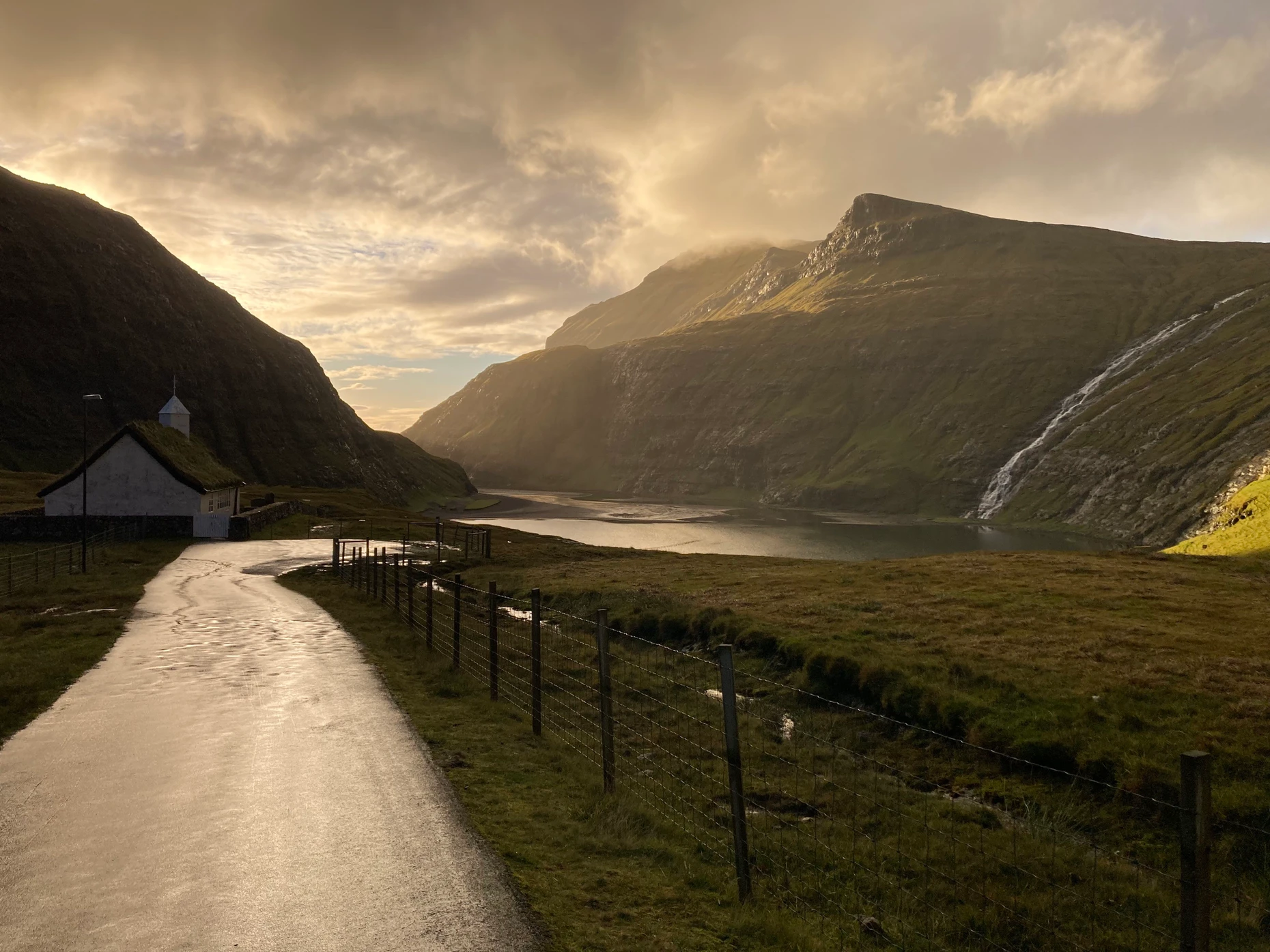
The final stage of the trek led into the valley of Saksun, a geographer’s dream of U-shaped glacial carving. The river running through the valley is a hydrological curiosity, flowing in different directions depending on the tides and the influx of mountain runoff. As the trek progressed, the weather shifted from light drizzle to a dense, all-consuming fog. Walking across the high plateau became a navigation of "steinhaufen"—large cairns—that serve as the only reliable markers in a landscape devoid of human structures. It was a meditative, albeit exhausting, experience of being caught in an "endless loop of mist and peat," where the concept of a summit ceases to exist, replaced by a series of rolling, identical thresholds.
Supporting Data: Tourism and Infrastructure
While the Faroe Islands have seen a surge in interest, the tourism footprint remains relatively light. In 2024, international visitors stayed for an average of just 2.5 to 4 days. A significant portion of this demographic consists of American travelers using the archipelago as a "natural transit zone" between North America and Europe.
The islands’ infrastructure reflects this dual identity: a blend of high-tech connectivity and deep-seated isolation. The sub-sea tunnels, which reach depths of 189 meters below sea level, are masterpieces of modern engineering, yet they serve communities that still operate on the principles of 18th-century maritime resilience.
Official Perspectives and Safety Protocols
Local authorities maintain a pragmatic, almost stoic approach to visitor safety. At the hotel reception, the advice for hikers is stark: "Take the average of three different weather apps, wear proper gear, and if you aren’t back by evening, we send a search party." This is not a deterrent, but a standard operating procedure in a region where weather conditions can shift from benign to life-threatening in minutes.
The government and tourism boards emphasize the importance of preparedness. The official hiking guide provided by the tourism authority is not merely a map; it is an essential survival tool that classifies trails by difficulty and potential hazard. They urge travelers to respect the land, noting that the "untouched" beauty of the islands is preserved precisely because of the environmental barriers that keep mass tourism at bay.
Implications for the Future
The Faroe Islands occupy a unique position in the modern world. They are a test case for how a small, isolated nation can integrate into the global economy through advanced infrastructure while maintaining a lifestyle deeply connected to a harsh, unforgiving environment.
The primary implication for future travelers is that the Faroes will never be a "plug-and-play" destination. The archipelago demands patience, humility, and a willingness to be interrupted. As the climate changes, the intensity of the North Atlantic storms may fluctuate, but the fundamental reality of the islands will likely remain: nature is the landlord, and humans are merely long-term tenants. For those willing to embrace the mist, the wind, and the isolation, the Faroes offer something increasingly rare in the 21st century—a place where the wild still holds dominion.
Travel Essentials
- Arrival: Atlantic Airways operates flights from Copenhagen and Edinburgh to Vágar. Prices fluctuate, but round-trip tickets typically range around €160.
- Navigation: The official Faroe Islands hiking guide is available for download through the local tourism portal. It is highly recommended to study these maps before attempting any trek.
- Preparation: Always carry high-quality waterproof gear, a reliable GPS, and extra food. Never underestimate the speed at which fog can descend, rendering visual navigation impossible.